Total Station Survey
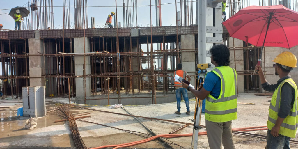
We provide comprehensive and highly accurate Total Station survey services to support all stages of engineering and construction projects—from initial planning to final handover. Our survey solutions ensure precise positioning, reliable data, and complete construction accuracy for every site condition.
Our professional survey services include:
- Topographic Mapping & Land Surveys – Detailed mapping of natural and man-made features for planning, design, and development purposes.
- Construction Layout & Setting-Out Surveys – Accurate transfer of design coordinates to the field to ensure correct positioning of buildings, structures, and infrastructure.
- As-Built / Completion Surveys – Verification of completed works against approved drawings for quality control and project documentation.
- Geo-Bag Dumping Position Surveys – Precise positioning and monitoring of geo-bag placements for river protection, coastal works, and erosion control projects.
- Monthly Survey Team Support – Dedicated on-site survey teams for continuous construction support and progress measurement.
- Road & Highway Surveys – Alignment, profile, cross-section, and right-of-way surveys for road and transportation projects.
- Bridge & Structure Surveys – Control surveys, setting-out, and monitoring for bridges and major structures.
- Railway Line Surveys – Alignment, track layout, and verification surveys for railway infrastructure projects.
- Transmission Line Surveys – Route alignment, tower positioning, and profile surveys for power transmission projects.
- Contour & Terrain Surveys – High-accuracy contour mapping and surface modeling for earthwork planning and site development.
- Other Engineering Survey Works – Customized surveying solutions to meet specific project requirements.
By using advanced Total Station equipment and experienced survey professionals, we deliver reliable, accurate, and timely survey data that supports safe construction, efficient project execution, and compliance with engineering standards.