Hydrographic Survey
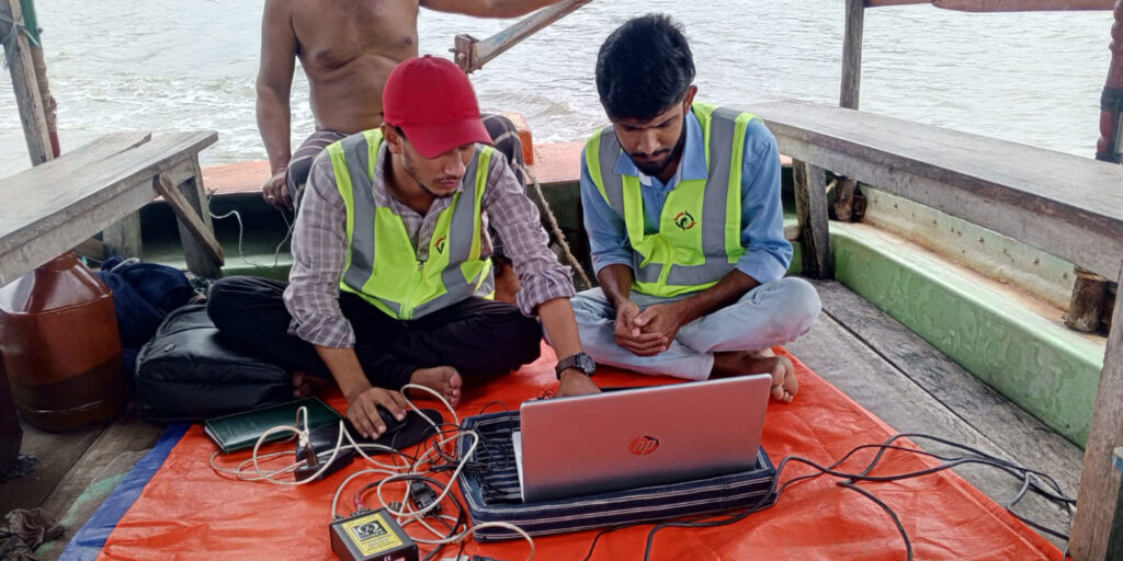
We provide professional hydrographic and bathymetric survey services for rivers, canals, lakes, and other inland water bodies, using modern echo-sounder systems and precise positioning techniques to deliver highly accurate and reliable depth and riverbed data.
Our hydrographic survey solutions include:
- Bathymetric Surveys – Accurate measurement of water depth and underwater terrain for rivers and water bodies.
- Longitudinal Section (Long Section) Surveys – Detailed river profile data along the flow direction to support hydraulic analysis and project design.
- Cross-Section Surveys – Regular and critical cross-sections for river training works, dredging design, and flow assessment.
- Riverbed Profile & Underwater Topography Mapping – Clear visualization of bed levels, slopes, and morphological changes.
- Dredging Support Surveys – Pre-dredging and post-dredging bathymetric surveys to assess existing conditions and verify achieved depths.
- Dredged Volume & Quantity Calculations – Accurate cut and fill volume computations for payment certification and project control.
- Monitoring and Comparison Surveys – Periodic surveys to track sedimentation, scouring, and channel changes over time.
- All surveys are carried out using calibrated echo-sounders combined with precise positioning, ensuring dependable results for river management, dredging planning, navigation improvement, and hydraulic engineering projects. Our reliable survey outputs support informed decision-making, efficient project execution, and compliance with technical and regulatory requirements.